
Why LiDAR Data?
LiDAR data is a valuable source of information for a wide range of applications, including forestry, urban planning, and infrastructure development. By integrating LiDAR data support into Geobase, we aim to provide you with a seamless experience for working with your LiDAR data, enabling you to gain deeper insights and make more informed decisions.
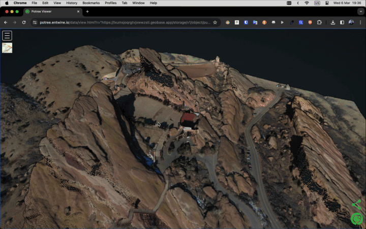
Visualizing with LiDAR Data
We're excited to share that Geobase will soon support LiDAR data visualization. This will enable you to view and interact with your LiDAR data in 3D, alongside other geospatial data types like satellite imagery and vector data, providing a comprehensive view of your project area.
Join Our Private Beta
If you're here, you're likely interested in our upcoming features. While we're still in the pre-launch phase, we're eager to share our vision and goals for Geobase. Stay tuned for more detailed updates.
Storing LiDAR Data
We're also thrilled to announce that Geobase will soon support LiDAR data storage. This means you'll be able to upload and store your LiDAR data directly in Geobase, making it easier for you to access and analyze your data alongside other geospatial data types.
Processing LiDAR Data
Beyond storage and visualization, Geobase will also support LiDAR data processing. This will enable you to run processing pipelines on your LiDAR data directly in Geobase, allowing you to perform tasks such as classification, feature extraction, and terrain modeling on your LiDAR data, enhancing your ability to derive meaningful insights from your data.